What is YAYSIS?
YAYSİS (Green Space Management System) is a spatial information system established for the proper and efficient execution of the construction, maintenance, and repair activities of the Department of Parks, Gardens, and Green Spaces throughout the city. The system, which was established in its current form with the determinations made on the current maps of 2017, application projects, and orthophotos, is measured and re-digitized as a hybrid by drone, mobile lidar, or terrestrial measurement methods according to the land morphology as of 2022, in the light of current data.
- Through the mobile mapping method, 360° measurable panoramic images and lidar point clouds of all avenues and streets will be taken.
- 360° Panoramic Photo Shooting will be carried out under sufficient light during daylight hours. There will be no shooting during low light hours such as the beginning of the day in the morning and the end of the day in the evening or at night.
- Location, date, and time information will be kept in panoramic images.
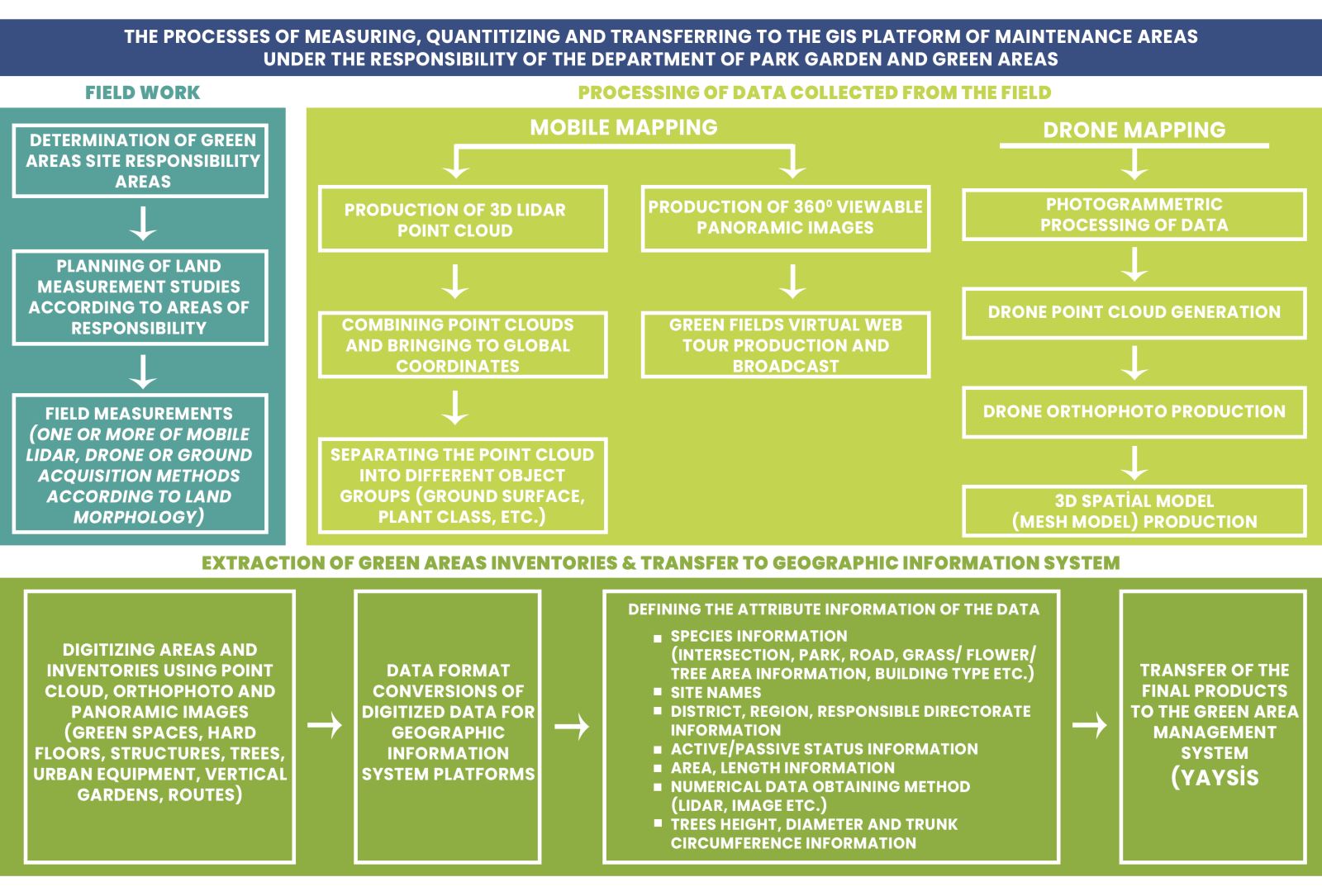
Data Collecting
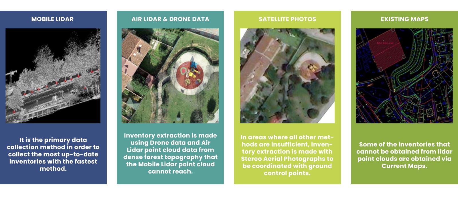
There are four methods for data collection.
Data Processing
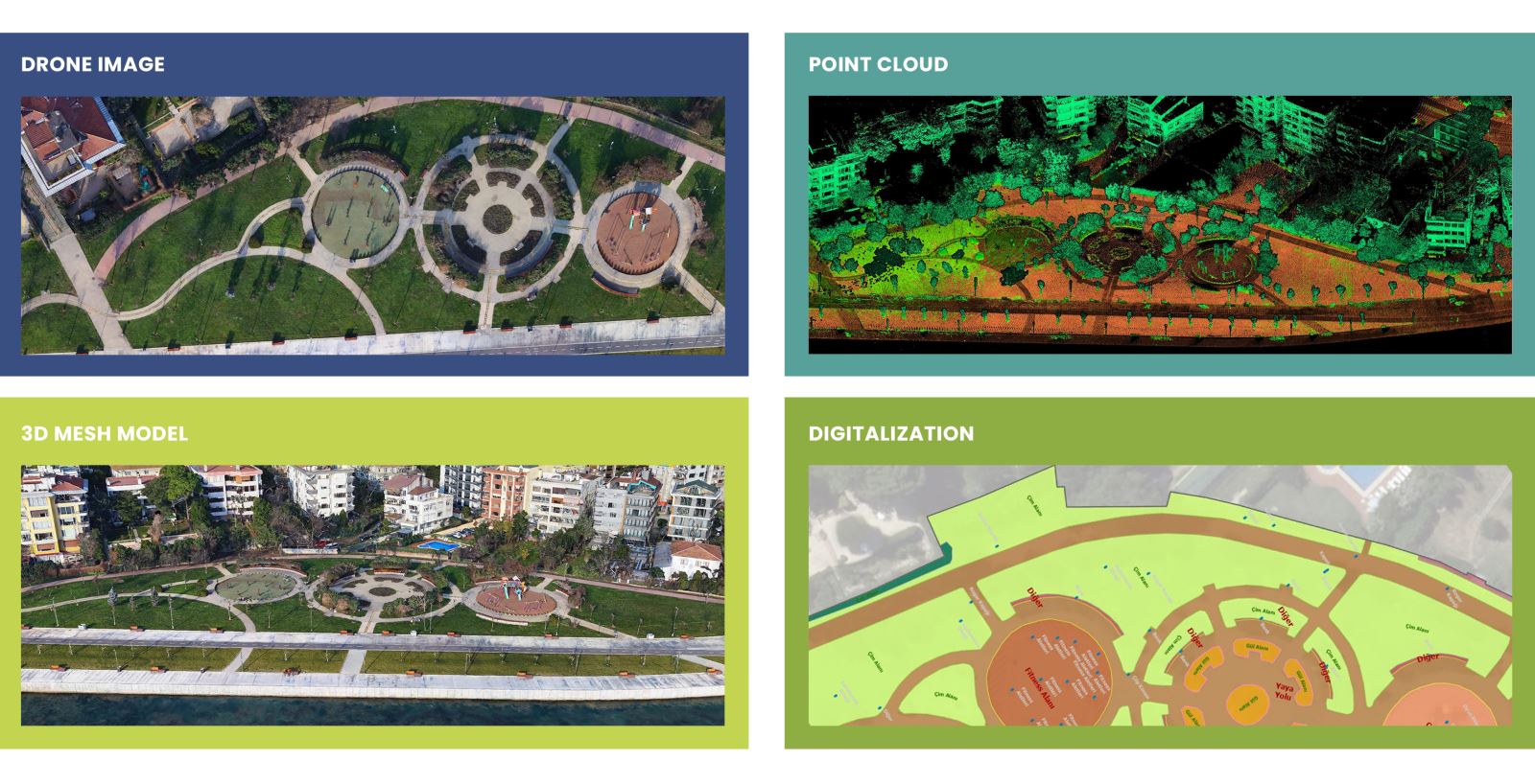
Through the data collected from the field, a three-dimensional point cloud is obtained with the “Stereo Image Dense Matching (SDM)” method, which absolutely reflects the reality of the land. This obtained three-dimensional point cloud contains high-accuracy X, Y, Z location information of any point in the field and color information of the terrain surface. For the highest accuracy, methods such as lidar, drone, and YKN are used crosswise. Using the produced 3D point cloud, a 3D Mesh model will be produced by triangulation.